


Choose from Eight Destinations Above
or just Scroll Down the Page

Copyright 2014 Bruce Melton and the Climate Change Now Initiative

Bruce Melton PE
Bruce Melton is our climate guide and expedition leader. He is a professional engineer, environmental researcher, author, filmmaker, front man for the band Climate Change and harp player extraordinaire.He has trekked, camped, climbed and caved from the frontier of Costa Rica to the wilds above the Arctic Circle. He has led trips and expeditions from deserted islands to two and half miles above sea level, camped in the desert and in Grand Teton in winter.In the early 1990s, during his stormwater research for the EPA, Melton discovered that what we were hearing in the media about climate change was understating what climate scientists were saying in their academic findings. After the turn of the century the disconnection grew so large that he began writing and speaking about climate change.Melton’s full color book on the latest climate science was scrapped when Al Gore published his full color “An Inconvenient Truth.” Seeing a need to go further, he picked up his cameras and went to Greenland, and deserted barrier islands, and Alaska, and the high Rockies, and began filming and writing about climate changes happening now.For ten years he has been reporting on climate science full time. His platform of investigative journalism at the nonprofit Climate Change Now Initiative is extensive and is produced directly from the peer reviewed literature and institutional findings. It includes over 400 reports on the latest climate discoveries, about 50 articles in the popular press, a book, two documentaries and several short films.
Lake Buchanan, Central Texas. The sixth year of the drought in Texas: Increased evaporation from soils and plants because of warming and longer dry periods has resulted in 50 percent less inflow than during the worst drought ever recorded in Texas.
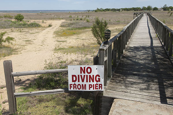
The Hill Country Drought:Four-wheeling on Buchanan
Lake Buchanan is about an hour and a half from Austin. The bed of the lake has been opened up to four-wheel drive trails by the locals who can\\\\\\\\\\\\\\\’t get their boats out into what lake remains. It\\\\\\\\\\\\\\\’s a retirement community out towards West Texas, so there are a lot of four-wheel drives around. We leave after breakfast tacos at Maria\\\\\\\\\\\\\\\’s on South Lamar and stay for sunset unless you want to catch some music in town. We can come out from the lake bed for barbecue at lunch at Cooper’s in Llano or take sandwiches. In the spring, bluebonnets cover large swaths of the lake bottom. The remains of the drowned settlement of Blufton are now exposed to view. Parts of the exposed lake bed extend two miles from shore. (Link to a summary pdf.)Most lakes are alive with buzzing watercraft and activity of all kinds. Even though there is still a lot of water at Buchanan, because there is so little access, the silence can be stunning. Nighttime is particularly enchanting in some of the really remote areas of what used to be the lake. The darkness is profound. The lack of normal lake background noise is quite reminiscent of an earlier time.It can be chilly when it is not summertime, which lasts from April until nearly Halloween, but even in summer a cool lake breeze can be found near the water. And there is water. And even though it is literally thousands of feet from shore right now, these lakes will surely fill again (and again). Just 17 months prior to the 90 days of 100 plus temps that accompanied the biggest spike in this drought in 2011, Lake Buchanan was 90 percent full.We do day trips as well as camping on the lake bed far from shore. Fifty miles of trail have been opened up on Buchanan since 2011. Camping on the lake bed is a truly unique experience and, it gives us a head start on a possible day two of this new wilderness adventure for a total dry lake immersion experience.Lake Travis is another of the five Central Texas Highland Lakes that are at between 30 and 40 percent of capacity. Lake Travis however, is quite different from Buchanan. It\\\\\\\\\\\\\\\’s a narrow canyon lake whereas Buchanan is a wide shallow lake (relatively). Buchanan has all the four-wheel drive trails. Travis has a lot of canyons and cliffs, little four-wheeling, but lots of view points.In the upper watershed above the Highland Lakes, there are six reservoirs that altogether total only nine percent of capacity. If we head up that way, we can tour the thousands of wind generators that now line the landscape in this part of Texas creating, literally, a new energy horizon.Wherever we go there will be plenty of time for photography, the discussion of climate science will be endless and we will likely get to chat with more than just one local. The lakeside residents are the ones that have opened up the four-wheel drive trails. Instead of going out in their boats, they ride their ATVs and four-wheel drive golf carts all over the lake bottom.Climate change behaves in extraordinary ways. The Highland Lakes Watershed has received 30 to 60 percent more rainfall in the last five years than it did during the worst five years of the state’s worst drought ever recorded, yet inflows to the lakes are only half of what they were during that drought of record in the 1950s. It is raining more but running off less because soils are drying more deeply and when it does rain, more soaks in and less runs off.
The volume of the Highland Lakes (including Buchanan) has been hovering just below 40 percent since the 100 degree day record of 90 days was set in 2011.
What to Bring:
Day hiking gear, sunscreen and sunglasses, a reusable water bottle, jacket or swim suit, gloves or towel depending on season. We can stay in a motel in the upper watershed if we get up that way. If we stay overnight on the bed of Buchanan, bring personal gear, we will bring the rest unless you have a favorite sleeping bag or tent.
Details:
Rates and Details:Departure: 8:30 am, but time varies depending on your schedule, especially if it is an overnight trip.For three persons, day trips start at $267 per person, camping from $250 per person per day, motel camp from $300 per person today.Trip Length: 1-7 daysDeparture Dates: Available by request or check the calendar. For a full rate sheet please call (512) 799-7998 or use the contact form.
Lakeway City Park on Lake Travis, another of the Highland Lakes of Central Texas. the red balls hanging in the air are the floats to the swimming area.
Padre:Adventure and Discovery on a Vanishing Barrier Island
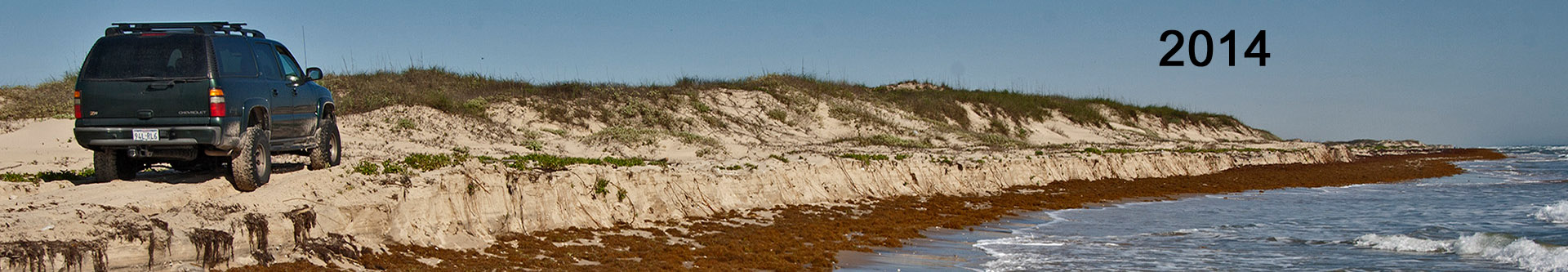
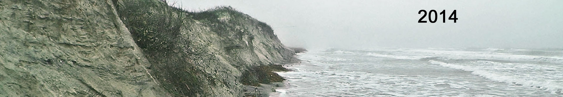
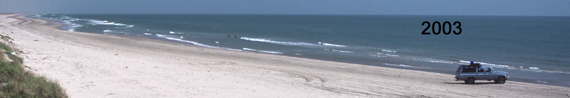
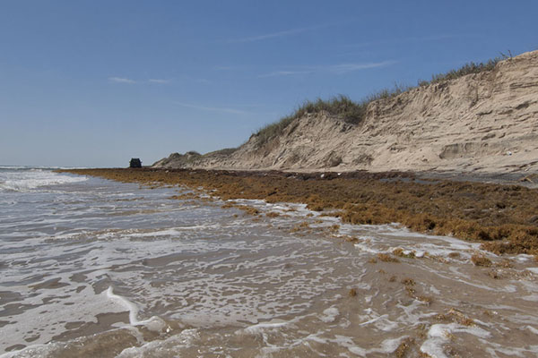
The 90 miles of four-wheel drive beach on Padre Island is our destination. This is just about the closest thing to an uninhabited wilderness beach that one can drive to anywhere. Spend the day, camp for a few nights or lose yourself in a week of deserted island exploration. We can also motel camp from Corpus, Port Aransas or South Padre Island. Whatever you decide to do, we will get to tour the eroded beach areas that so few can see because of its remoteness, and talk climate science till the tide comes in. (Link to a summary pdf.)Most of the beach is still there. Though much smaller than it was ten years ago, there are only a handful of badly eroded areas totaling three to five miles of the total four-wheel drive beach mileage of 90 miles. Some places on some beaches are at more risk of erosion than others because of local currents, man made features or different sand nourishment issues. When sea level rise on a barrier island reaches seven mm per year it begins to fragment and disappear. The 20th century rate at Rockport is 5.2 mm per year and sea level on the Texas coast appeared to begin to rise more rapidly when the Big Melt in Greenland began. This is why the most erosion prone areas on Padre have begun to erode. The threshold is near.The beach is cut by Mansfield Pass 65 miles from the end of pavement south of Corpus, so to see the whole thing we must drive to Mansfield Pass on the beach, turn around and drive back to Corpus then drive on pavement on the mainland to Brownsville then up South Padre Island to the end of the pavement where it’s 25 miles to Mansfield Pass again. The four-wheel drive starts about five miles from the end of pavement in both directions. To camp the entire Padre Island north to south is a minimum three-night trip but a camp on either north or south can be done in two. If you only have time for a day, we may or may not be able to make it all the way to the eroded area on North Padre, but it\\\\\\\\\\\\\\\’s pretty much guaranteed to get to the first eroded area (The Narrows) on South Padre. North Padre can be slow and brutal if the water is up and the sand is soft and six or seven hours of that is about all that anyone deserves…Motel trips can be more than one day as well because when beach driving is bad we may have to time our drive down the beach to take advantage of low tide. The great benefit of motel camping is of course–seafood! And btw, if you are “in” to it and have the time, I have eaten many of the best seafood meals ever consumed from the sands of the four-wheel drive Padre Island Beach. Either from the fly, spinning gear or with bait, I have fished them all and would love to share if you have the time.North and South Padre Islands also have very different character. North is lined by a continuous row of dunes 25 to 100 feet from the high tide line. South Padre has numerous wash-overs where a big hurricane in 1997 cut the island to shreds. These washovers have yet to heal and present large areas of young dunes that have not been covered by vegetation yet.South Padre also has beach art. A local artist uses beach trash to build sculptures up and down the four-wheel drive beach that have to be seen to be believed.
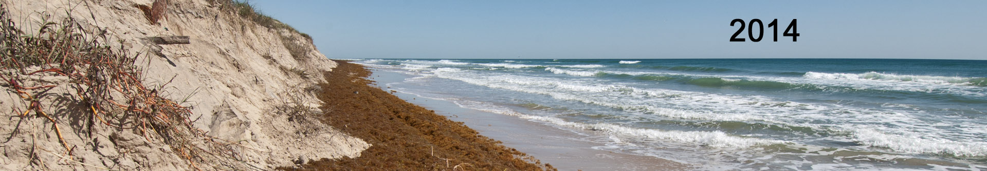
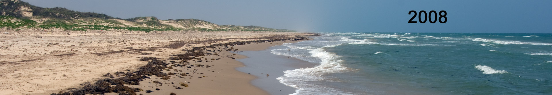
South Padre Island, about eleven miles beyond the end of pavement. There are three areas on South Padre where sea level rise has eroded into the dunes for a total of three or four miles. This is a normal high tide. Padre Island National Seashore to the north has one area not quite this bad that first eroded in the fall of 2013.
Both beaches have the usual wildlife which includes deer, coyotes, badgers and millions of ghost crabs. The highlight of the wildlife year though is the shorebird migration. The last couple of weeks of April or mid October are usually peak season, but it varies by a week or two.The number of birds can be astounding with literally millions being seen in a single day. When the wind is right and the birds feel like moving they flow down the beach in and endless procession along the narrowest space where water meets sand.Days are almost always windy and mosquitoes are rarely a problem. Nights are as dark as the inside of a cow. It can be really cold in winter, but generally it’s not so bad. It can be really nice on North Padre in mid and late summer when the cool water is close to shore. This happens at times when the north and south currents that meet at the Devil’s Elbow (the big bend of the Texas coast), force water in the 70s close to shore. It’s not reliable so don’t count on it and at its hottest, late summer is bearable, and we will set up shade in the middle of the day if we stay in one spot for long enough.The ideal trip traverses both ends of the beach with one night on South Padre and two on North. But this is a busy trip and there is no time to really spend a full day at camp without driving. If you want to do this, plan on four nights or more.Longer trips allow one to develop their inner beach self. A transformation occurs on a deserted island after the end of day two. The wind becomes mesmerizing, the sand no longer bothers you, the sun warms your soul. It\\\\\\\\\\\\\\\’s is hypnotic and satisfying to a degree that is hard to describe to one that has had the experience.We sleep two to a tent in four-person mountain tents capable of withstanding hurricane force winds. Always be prepared for a big blow when camped on the beach. A normal day on Padre sees winds in the 15 to 25 mph range, a normal windy day is 25 to 30 with higher gusts. Sleeping bags and pads are provided, you bring everything else unless you have favorites. Don’t forget a sheet for warm nights (which are most of them).The sand is not really bad at all if you follow a few simple rules: Bang your feet together before you get in the suburban and always use your water bucket to wash your feet off before you get in the tent.Another benefit of staying several days is that it’s much easier to take long walks into the flats on the backside of the island. But there is the reality of climate change. The flats were submerged in 2013. That does happen occasionally, although I have not seen it happen in ten years. They may return again, or they may not. Whatever the answer, their time submerged will be greater in the future.As your reward for camping, especially if you have never camped on the beach, you will get to really experience this critically endangered environment. There may be a time, sooner rather than later, when this opportunity will no longer exist.
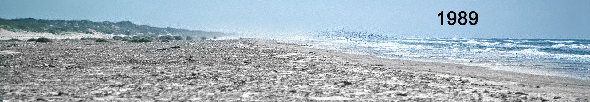
The shorebird migration can be truly spectacular–if we can catch it. It peaks for about two weeks in October and April. Which two weeks is the key. This is North Padre Island, about mile 40 beyond the four-wheel drive only sign.
What to Bring and What We Eat:
Day pack, sunscreen and sunglasses, a hat that fits well (wind) two reusable water bottles, jacket and swimsuit. Even in late summer when the air temperature never falls below 82, a light jacket can be needed. After a long day with lots of sun, that ever-present stiff breeze can create quite a wind chill. Bring enough clothes to cover any situation including running back to town for more bear or a seafood dinner. Winter gear can be useful in the cooler season as that old windchill takes no breaks. And bring an extra towel for drying off your feet when ensconcing yourself in the tent for a sleep. Remember, that bucket of water for washing off sand at the door of your tent is one of the most valuable things you will ever encounter on a beach camping trip. We can stay in a motel or camp. Bring beach shoes (Tivas, camping sandals, etc.) and hiking boots for the flats on the backside of the island. Bring personal gear. We will bring the rest unless you have a favorite sleeping bag, pad or tent.Food will be burgers or steaks or backpacking freeze dried depending on how long we stay out. Two nights is about the limit for non-freeze dried food if we want to take more than one or two beers per person. If the suburban is full with clients, ice chest food and refreshments will be limited.Breakfasts will be bagels, cream cheese and fruit or breakfast bars plus fruit and always excellent strong fresh ground coffee (or tea). Lunches will be sandwiches or canned meat, cheeses and bread or crackers and raw veggies and cherry tomatoes. Canned fruit will substitute for fresh when we run out. Backpacking meals will reign on longer trips unless we re provision (which usually happens along with a surprise seafood dinner!).Details and Rates:Departure: 8:30am, but time varies depending on your schedule.Rates start at $220 per day per person or $1,540 per person per week camping with three expedition members plus guide per trip. Stay at a motel or resort and eat seafood every night beginning at $280 per day for a week at $1,960, with three expedition members and guide.Trip Length: 1-7 daysDeparture Dates: Available by request or check the calendar. For a full rate sheet please call (512) 799-7998 or use the contact form. Unaccompanied Persons: If you want to save some money and can coordinate schedules with others, let us know and we will try and match you with others in the same situation. If you begin planning early you will have a greater likelihood of succeeding.
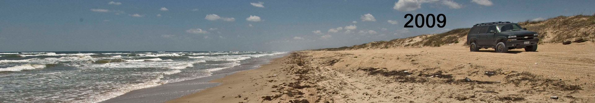
This is mile 25 beyond the four-wheel drive sign on Padre Island National Seashore. This the grueling “foot of the dunes trail.” It is usually the only one available any longer. Sometimes it is not so bad. When it rains the sand stiffens up, but often it will be an incredible slog through sand that\\\\\\\\\\\\\\\’s so soft and dry it is difficult to walk through. Not many people make it this far.
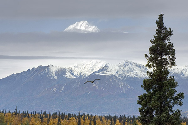
Drunken Forests, Disappearing Dirt: Permafrost Melt in Alaska
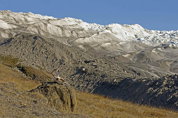
Permafrost can be millions of years old and thousands of feet thick and it covers more than half of Alaska. Normally it is discontinuous in areas where people are found and normally, the uppermost feet to inches thaw every year allowing plants to grow during the warm season. Even the deepest permafrost is warming and much of permafrost in Alaska has warmed by at least several degrees. (Link to a summary pdf.)It takes 289 times more energy to change ice at 32 degrees to water at 32 degrees than it does to warm water by 1 degree. Some permafrost can be 90 percent water, creating massive geologic havoc when it melts.The ideal way to see Alaska is in a rented RV. Ideally, up to four can join us in one RV but the three beds require close company for two of the beds. We can provide an expedition grade tent, bag and pad too if you don’t have a partner to sleep with. We will rent a 22 to 26 footer, the smaller the better for where we will be going.Permafrost is not all that common very near Anchorage but once we get to the Alaska Range it is quite common. Our itinerary can be anything the group can agree on that we can cover in our allotted time. Because there are so few roads in Alaska, the identified spots that have been scouted for permafrost and glacier melt visits are “on the way” in most instances.If you have never been, Denali National Park is a must. You simply “have to see the mountain.” One of my favorite places is the Denali Highway south of the Alaska Range (Alaska Route 8). It is 133 miles of gravel, almost entirely deserted and totally spectacular. Some of the most incredible permafrost slumps I have ever seen are here.Stops will be plentiful. Plan on travelling a day then laying over a day, or we travel when and where the group wishes. We will shoot for about 700 or 900 miles of travel in a week and 1,200 or 1,500 in two weeks but again, the group rules.The week-long trip does the big loop around the state on Alaska 3 past Denali to Fairbanks, Alaska 2 south to Delta Junction, Alaska 4 south to Paxson, Denali Highway east (Alaska 8) as far as we can stand it and turn around (washboard gravel), then south on Alaska 4 again to Gakona Lodge where we hit Alaska 1 that takes us back to Anchorage.We will usually end our stay with a layover day at the Matanuska glacier about 100 miles east of Anchorage. This is an excellent opportunity to study a rapidly retreating glacier and it lets us get back to town to check in the RV and still catch a plane back to the states.A one week trips is fast and furious, but two weeks gives time to experience. With two weeks we get several layover days to shake the travelling malaise and warm the soles of our feet tramping around looking for melt, bears, moose, salmon or any of the other Alaskan natives that may be handy. The food is also a bit better on a longer trip as we have a little more time to relax and cook steaks on the grill.
When The Mountain is out, life is good. The mountains in Alaska are huge, but “The Mountain” (Denali) makes the rest look like children. You can see it from well over 100 miles away. The call it McKinley “outside.”
Photo opportunities will abound. We will have time for everything but radical stake-out wildlife photography and on layover days, by all means. Each day we will spend a few hours in the morning and evening in camp to experience wherever it is that we are, unless we have to hit the road early or drive late to get somewhere.Rain is also very common in Alaska in most summers so raingear and waterproof boots (preferably Gore-Tex hikers) are a must. During wet years, gators (that cover boot tops and pants below the knees) are a must because we will be investigating permafrost melt in off-trail areas almost daily. Bogs are widespread and often we will have to cut through instead of going around as often, there is no “around” to go to.Melting glaciers are accessible in several areas and we will not want to miss these opportunities to explore. The ice affords surprising stability for those who have never been. It is slick, but nothing like glare ice on a sidewalk that can kill. Good hiking boots with deep or relatively new lugs are suitable. If conditions are too slick, we won\\\\\\\\\\\\\\\’t go there. A significant injury from a unwarranted fall on a trip like this is not worth it.In the autumn, the entire state turns yellow as the predominant aspen loses its leaves (first three weeks of September). Tundra vegetation, mountain scrub and understory plants create a riot of reds and golds. Bears, elk, wolves and caribou are scene regularly; even more regularly than “The Mountain.” But Denali (Mount McKinley) is often visible and it is visible from well over a hundred miles away at times.Don’t expect trouble from bears and “other predators” as long as you are with the group and follow instructions and instructions will be provided in ample quantity.It can be cold in the summer and really cold in the spring and fall with snow common. But the snow does not stick around long and the RV comes with a heater that warms it up quickly on cold mornings.What to Bring and What We Eat:Day pack, sunscreen and sunglasses, a water proof or resistant hat that fits well (wind), two reusable water bottles, jacket, heavy coat, insulated underwear and even snow pants if you are coming along at the end of the fall color season. It\\\\\\\\\\\\\\\’s not that the snow will be deep, they provide an extra level of coziness when winter makes an early show. I personally bring insulated overalls so I can sit by the fire and not freeze my back off. Bring warm gloves and or towel and swimsuit depending on the season and if you want to experience any of the hot springs we may encounter. Bring medium duty waterproof (Goretex or equal) hiking boots with moderate to heavy lugs (glacier hiking), town shoes if you like, and personal gear. Rain Gear—Goretex or equal! We will provide sleeping bags (warm ones!) and RV gear and dishes, sheets, pillows and such, bring your own sleeping bag if you like if it is really warm! It gets cold in those RVs. We will run the auxiliary heater a little on the colder days, mornings and evening, but no more (safety!).We will mostly eat from the galley in the RV because there are not that many towns in Alaska. We will hit the grocery in Anchorage and start off the trip with a full larder of our favorite foods. A few “store trips” are always anticipated, but only in Anchorage and Fairbanks are supplies “abundant” (hey, it’s Alaska!). Let me repeat about clothing: bring very warm clothing—winter weight gear for southerners, even in mid-summer.
This is a permafrost melt lake. Permafrost can be 90 percent ice, so when it melts there is not much dirt that remains. After the initial melt, a permakarst lake forms. Then, the water slowly drains away leaving a pockmarked and chaotic surface. Some places the vegetation takes over relatively rapidly, but much of Alaska is not really known for its rapid vegetation growth.
The food will not be extravagant; think family vacation. But we will have a couple of steaks on the grill, maybe some salmon and the rest of the time canned: soup, potatoes and veggies, stove-top meals or freeze dried backpacking pouch dinners (which are really quite good these days, especially after a hard day outdoors when we are tired and don’t want to cook and clean ~ ~ ~ ). We will organize a list pre-departure so we don’t waste time in the grocery when we could be on the road *******Breakfasts will be bagels, cream cheese and fruit or breakfast bars plus fruit and always excellent strong fresh ground coffee (or tea). Lunches will be sandwiches or canned meat, cheeses and bread or crackers and raw veggies and cherry tomatoes. Canned fruit will substitute for fresh when we run out.Don’t forget personal medications! Prescriptions! Spare reading glasses! A book or two for… (I couldn’t be without mine…) a flashlight, a bandana or two, a pocket knife! Extra Socks! We will have a decent first aid kit, but try really hard not to break any bones.Trip insurance with injury and hospital coverage is mandatory. If you do get hurt, and these trips are on the edge of things, you will thank us for having the foresight to require trip insurance.Rates and Details:Rates start at $337 per day for 14 nights/15 days traveling in a 25 ro 28 foot Class motorhome with four people plus guide for $5,050 per person.Departure Dates: Available by request or check the calendar. For a full rate sheet please call (512) 799-7998 or use the contact form. Trip Length: 7 or 14 daysUnaccompanied Persons: If you want to save some money and can coordinate schedules with others, let us know and we will try and match you with others in the same situation. If you begin planning early you will have a greater likelihood of succeeding.Custom Tour: Want to extend a trip or just tour for eleven days? How about a destination not listed or a combination other than what is listed? Contact us about a custom tour.
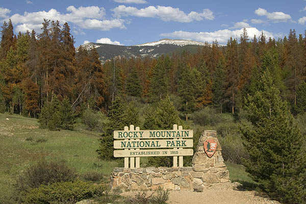
Search for the Red Forests: The Great North American Pine Beetle Pandemic
They said insect infestations would be greater on a warmer planet. Across the Rockies of North America, a single species of native bark beetle has devastated over 80 million acres of forest in an attack that is ten times bigger than any on record. In the Rockies proper the attack is slowing, but this is likely only because the beetle has run out of food. (Link to a summary pdf.)This infestation started with drought in the late 1990s and even though precipitation has returned, the drought continues. A little extra warming creates a lot more evaporation, melts snow earlier and creates a longer hotter summer. Only extreme cold can kill the pine beetle and those winters basically disappeared almost twenty years ago. All of these things have allowed beetle populations to explode.This trip can be as extreme or vacation-like as you want. We are likely to see more red forests on the extreme side of things, but there will be devastated forests everywhere we go.All is not doom and gloom however. The centerpieces of these trips will be our national parks. They are just as majestic as ever. Beetle attack and forest fires that wipe out forests are not unknown you know. They have left massive swaths of mountainous country decimated since time began. The difference this time is in the scale of the attack.We travel in “The Ice Melter.” This is a four-wheel drive suburban lifted with 33 inch tires. It is fully capable of just about the most extreme four-wheel drive roads in the Rockies and this is just where we will be going. Camp will be anywhere we want in a national forest, state or national park. Seriously. Want to camp above treeline at 12,000 feet? No problem. Want to take a few days and see the geothermal features at Yellowstone? No problem.A mountain pine beetle impacted forest is different every year. Traditionally the beetle attacks lodgepole pine, but attacks of ponderosa, white bark and jack pine are happening as well. The trees do not appear dead until the second year when they turn red, hence the term “red kill.” The ponderosa turns a fiery orange when it succumbs the year after the attack.In the third year, red kill becomes evident in patches of 5 to 50 dead trees. Forest professionals call this stage “spotting.” Over the next few years the “spots” grow larger until the spots coalesce into entire mountainsides of red kill. This has happened across entire mountain ranges in the North American Rockies.The beetle kills about three quarters of the trees in any given stand. In forests with a higher kill rate it looks as if a fire has come through, though the trunks are not black and all of the small limbs are still on the trees. As the needles fall the dead trees disappears back into the forest in a mirage-like way because the grays and browns blend better with forest tones than bright red.
Rocky Mountain National Park has been hit hard by the pine beetle. This photo was taken in 2008 and these trees are all needleless and gray now and some of them have started to fall. Along the roadways the trees have been cut to prevent falling hazards and most of the trees have now been cut from several campgrounds within the park.
These trips are big road trips. You can join in Austin, Denver, Jackson Wyoming and Calgary, Alberta (or contact us about alternative starting points). Rocky Mountain and Yellowstone National Parks are focus destinations as are national forests from New Mexico to Montana and Idaho. We can go as far north as the southern reaches of the Yukon Territory in Canada. Even the red rock country and Anasazi ruins around the four corners area are on the list. In the early 2000s, this region experienced a three million acre pine beetle attack of pinyon pine, larger than Rhode Island and Delaware combined.Widespread areas of beetle kill will be evident in most places we visit, but finding red trees may be a challenge. Clearcut and closed campgrounds are common. It is taking years to get just the campgrounds safe again.Mostly we will camp, but once or twic a trip (if you like) a motel will be sought out for a nice place to get cleaned up. Meals are standard camping fare and because this is generally a big road trip, there will be plenty of opportunity for fast food and restaurants.In the lower 48, red kill from the mountain pine beetle is active in central and northern Idaho, west central Montana and northern Colorado east of the Continental Divide and north of Rocky Mountain National Park. We will likely find active beetles everywhere we go, but these are the hot spots today.The big spruce beetle kill is still active in southwest Colorado and significant spruce beetle kill is also along the Continental Divide west and north of Rocky Mountain National Park. Spotty areas of red kill are located throughout the West, but mostly the beetle is in decline because, as forest professionals say, they have killed most of their food.Mountain pine beetle larvae have successfully overwintered in the southern Yukon Territory adjacent to infestations in northern British Columbia and have successfully adapted to the jack pine. The great concern of forest professionals today is that the beetle will make its way across Canada to the Atlantic and down the eastern seaboard of the U.S.The biggest attack in North America is now in west central Canada. To get there we will visit the heart of the Canadian Rockies at Banff and Jasper National Parks, then scoot west to the epicenter of the old British Columbia beetle attack of 30 million acres from the 2000s, then head north for the great boreal forest of the sub-arctic and the border of the Yukon through some of the most fantastic and remote mountain scenery in North America. This is a three thousand mile loop from Calgary that will see hundreds and hundreds of miles of red forests.Search for the Red Forests is the crowning jewel of Climate Adventure’s road trip expeditions. Expect anything and come prepared for everything. What to Bring and What We Eat:You can bring a standard military duffel stuffed as full as you can get it, but be warned, they are the dickens to haul around the airport at maximum crammed capacity. Everyone can bring a modest sized daypack stuffed full as well. Photographers, please limit to a medium one-shoulder bag with two lenses and a tripod. To make it fair for the non photographers, feel free to bring an equal sized pouch for whatever you want to bring.Important gear: Day pack, sunscreen and sunglasses, a hat that fits well (wind), two reusable water bottles, jackets (light and medium), gloves. Medium duty waterproof hiking boots with moderate lugs (glacier hiking), town shoes if you like, swimsuit and extra towel for hot springs. Rain Gear—Goretex or equal! Bring personal gear. We will provide sleeping bags (warm ones!) and pads and four-season hurricane proof expedition quality tents, or you can bring your favorites. There will be an adequately stocked camp kitchen on these trips as well as a couple of backpacking stoves. Bring your own pillow and such, and remember, it gets cold in the Rockies at the altitudes that we will be staying.More than half the time we will eat camp meals because it will be too far to go to town for dinner. We will hit the grocery stores in little towns we come across and they usually have great steaks for the grill. But supplies will not often be abundant, so we will have backup backpacking pouch meals (which are really quite decent these days), and canned: soup, potatoes and veggies, as well as bread, cheese, fruit, snack bars and a few surprises.Warm clothing is a must which includes winter weight gear for southerners, even in mid-summer. Bring the best breathable (Goretex) raingear you can dare to afford. At altitude it rains very often in the afternoons and when it does the temperature drops immediately into the 40s then sometimes into the 30s! If there is a sight to be seen we will not want to sit in the truck unless lightning is present. Frost is a regular occurrence even on midsummer mornings and snow is not uncommon anytime. I prefer a Goretex parkashell and standard rubberized rain pants. Gators are really nice for morning hikes with the ever-present dew soaked grass.Breakfasts will be bagels, cream cheese and fruit, breakfast bars or something fast, maybe even McDonald’s and always excellent strong fresh ground coffee (or tea). Lunches will be sandwiches or canned meat, cheeses and bread or crackers and raw veggies and cherry tomatoes or maybe a burger if we are near a town. Canned fruit will substitute for fresh when we run out.
Entire mountain ranges have been attacked. Forest Service, state, county, and utility provider budgets are stretched thin attempting to cope. Ecosystems are changing rapidly. This image was taken in Rocky Mountain National Park in 2008. Across Colorado, over four million acres have been attacked like this. For scale, Yellowstone National Park, much larger than Rocky Mountain National Park, is 2 million acres.
Rates and Details:Our climate specialist guided RV tours start at $308 per day for four persons or $4,613 per person for 14 nights/15 days traveling in an 25 to 28 foot Class C motorhome with three expedition members plus guide.*Four-wheel drive suburban expeditions start at $363 per person for $5,075 for 14 nights/15 days with three expedition members plus guide.*** Off-Season Discount for RV Trips September 4 through May 21 (-) $50 per day from total (not per person).** Four-wheel Drive Suburban trips book for a maximum of three passengersDeparture Dates: Available by request or check the calendar. For a full rate sheet please call (512) 799-7998 or use the contact form. Search for the Red Forests Destinations (up charges):1) One week trips:Durango — Central and southwestern Colorado (no additional fees)Denver — Rocky Mountain National Park to Yellowstone (no additional fees)Jackson Wyoming – Extended Yellowstone (Add $300 to total per person)2) Two week trips:Denver – Rocky Mountain National Park, Central and southwestern Colorado (no additional fees)Denver – Rocky Mountain National Park to Yellowstone–extended Yellowstone area (no additional fees)Jackson Wyoming – Yellowstone, Idaho and Glacier National Park (add $600 to total)3) Boreal Forest Canadian Rockies: Loop through northern British Columbia Rockies, southern Yukon Territory, northwestern Alberta (Four-wheel drive Suburban only, limited to three persons, add $2,000 per person)4) Single occupancy add $75 per night.Unaccompanied Persons: If you want to save some money and can coordinate schedules with others, let us know and we will try and match you with others in the same situation. If you begin planning early you will have a greater likelihood of succeeding.Custom Tour: Want to extend a trip or just tour for eleven days? How about a destination not listed or a combination other than what is listed? Contact us about a custom tour.
This image was taken north of Steamboat Lake State Park, north of Steamboat Springs in north central Colorado in 2009. The trees in the foreground are ponderosa pine. On the mountainsides they are mostly lodgepole.
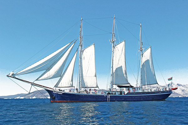
Sailing with Rembrandt: Icebergs in Greenland
ClimateAdventures.org and Halintours is offering tours aboard the three-masted schooner Rembrandt of Oceanwide Expeditions (itinerary). The Rembrandt is a 168 foot ocean going sailing vessel with a hardened hull for duty in Arctic waters where ice can be a hazard. (Link to a summary pdf.) We will sail the coast of Greenland from Davis Strait and Baffin Bay, visit the the active icefjords, and taek the Zodiacs to shore every day we cMost of these icefjords have seen increased discharge of bergs due to warming. But sea ice has decreased significantly and waters warmed alarmingly. The Initiative’s first documentary, The Ice and the Sea, is about Greenland melt, ice discharge and sea level rise. This film was shot in Greenland and on the vanishing Padre Island National Seashore.With increased media coverage of warming in Greenland, these tours are becoming quite popular. The warming has increased ice discharge over 600 percent since 1992.These tours are “Zodiac” events with daily excursions to calving glacier fronts and Greenland settlements in these bulletproof expedition grade rubber dinghies. This trip is focused on the west-central Greenland coast around Ilulissat and the Ilulissat Icefjord World Heritage site. Cruises extend north far beyond the Arctic Circle and points north, expect to encounter ocean wildlife of all kinds as well as majestic icebergs in all of their dazzling glory.
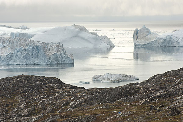
Several icebergs, the size of small towns, dot the seascape off the western coast of Greenland like moveable islands as a fisherman culls his haul.

The ship is powered by two Cummins engines capable of 9 knots as well as sailing power. It was built in Norway in the early 20th century for the herring fleet and upgraded to passenger status in 1994. Its latest refurbishment was complete in 2011 bringing it to current international standards. She has a crew of nine and two tour guides other than our climate expert.Oceanwide says up to 33 passengers can be accommodated and they “are characterized by a strong interest in exploring remote regions. The camaraderie and spirit that develops aboard is an important part of the expedition experience. Many departures have several nationalities on board.” Our portion of these tours will consist of 8 to 10 individuals.These trips can be made as a stand alone vacation or in combination with one or more of our shore expeditions listed below.Please view the Oceanwide website for more information about the Rembrandt and their expeditions at:Rates:Please contact us for rates. We are booking for the 2015 season now. Booking dates are early for these trips as there is a lot of interest and berths and hotel accommodations fill by the first of the year. Expect to book by Christmas at the latest.
Water temperatures have warmed 7 to 9 degrees F recently leaving some fisherman out of work as the fish search for cooler water. To make a living, fisherman have begun to ferry tourists to view the incredible scenery.
Kangerlussuaq, Point 660: Inland Ice
There are two options for visiting the ice sheet at Kangerlussuaq. One is to stay at Old Camp in town and “commute” the 22 miles to the ice sheet daily. Old Camp is the old hostel in Kangerlussuaq (not a camping thing at all). The other option is to camp next to the ice. The “commute” version closely follows the camping version except excursions are much more limited in time on or near the ice and we return every night to the modern facilities at Old Camp. (Link to a summary pdf.)Camping expeditions begin at Old Camp in Kangerlussuaq where we will spend a day preparing for camp next to the ice. We will base camp within sight of or within rock throwing distance of the ice sheet. Each day we will trek to points on and along the edge of the ice and return to camp in the evenings or maybe we will make multiple hikes per day, or just sit by the massive ice cliff on the glacial lake and wait for ice falls.The itinerary will be somewhat freeform to take advantage of changing conditions. At few places in the world are conditions changing as rapidly as here.Trips prior to about August 1 will be prone to having mosquitoes by the gazillions depending on wind direction. An off-ice wind blows them out, but it is colder from that wind direction. The first fall freeze happens in early August basically taking out the mosquitoes almost completely.The ice is not all that slippery and plenty of decent routes exist through the rough stuff. Moderately lugged hiking boots are adequate for the summer work we will be doing.Goretex (or equal) raingear is must because when it rains (if it rains) you will not want to be tent bound and when and it is always cold when it rains and you will not want to be wet. Cold weather clothes are a must, but do bring a few warmer weather pieces. It may snow, and it will likely be extremely windy at times. At these times snow pants may be preferred, but at others you would be tempted to wear shorts.Of course, bring your preferred mosquito repellent and hope you don’t have to use it. After it snows (a possibility any time) sunglasses are a must. Sunblock too. Sunny days on the ice sheet can produce real snow blindness that is debilitating as well as excruciating. Do not forget sunglasses.A porter will be available to haul gear from the road to camp and back, which will be placed a respectable and responsible distance away.Potable water will likely be in relatively short supply, but a minimum of a gallon per day will be supplied. There is a great variety of different qualities of water along the edge of the ice sheet and we will have a UV sterilizer and a filter.
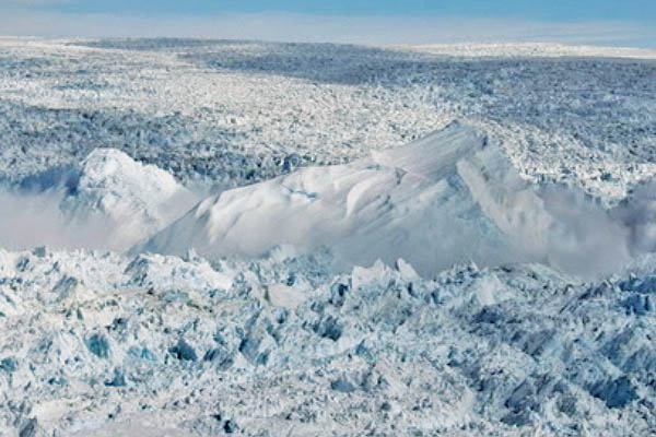
The ice sheet towers 1,000 feet at its edge in some places. This image was made a few miles south of Point 660 near Kangerlussuaq. We will pitch camp near here and explore.
You can bring a standard military duffel stuffed as full as you can get it, but be warned, they are the dickens to haul around the airport at maximum crammed capacity. Everyone can bring a modest sized daypack stuffed full as well. Photographers, please limit to a medium one-shoulder bag with two lenses and a tripod. To make it fair for the others, feel free to bring an equal sized pouch for whatever you want to bring. Important gear: Day pack, sunscreen and sunglasses, a hat that fits well (wind), two reusable water bottles, jackets (light and medium), gloves. Medium duty waterproof hiking boots with moderate lugs (glacier hiking), town shoes if you like. Rain Gear—Goretex or equal! Bring personal gear. We will provide sleeping bags (warm ones!), pads and hurricane proof four-season expedition grade tents, or you can bring your favorites. There will be an adequately stocked camp kitchen on these trips as well as a couple of backpacking stoves. Bring your own pillow and such, and remember, it gets cold in Greenland next to the ice!Most of our big meals will be backpacking pouch meals and these are really quite good these days and full of calories. A large variety will be brought along and this will be supplemented with cheese and bread and other local fair such as canned soup, potatoes and vegetables from the local market. The ubiquitous snack bars will be available in plenty along with a few surprises.Warm clothing is a must which includes winter weight gear for southerners, even in mid-summer. Bring the best breathable (Goretex) raingear you can dare to afford. The weather is highly variable in Greenland and it rains often and the temperature drops immediately into the 40s then often into the 30s! We will not want to sit in our tents and wait. Frost is a regular occurrence in late summer and snow is not uncommon anytime. I prefer a Goretex parka shell and standard rubberized rain pants.Breakfasts will be backpacking pouch wonders (again, really quite good) or breakfast bars and always excellent strong fresh ground coffee (or tea). Lunches will be canned meat, cheeses and bread or crackers and canned fruit. Fresh fruit and vegetables at the market in Greenland are a far cry from what we are accustomed to on the “outside.” Clean Laundry: on two week trips we will try and hit a Laundromat mid tour but no guarantees. Daily washing is done from a bucket. If we are out for more than four days a lean-to will be set up for a more thorough sponge bath. A “special bucket” with a special lid will be provided, placed in an appropriately secluded location or in its own special mini-tepee.
The moraines at the foot of the ice sheet are sometimes 200 feet high geologic infants only thousands of years old. The last ice age, that ended about 10,000 years ago, wiped most of them out and they have been rebuilding since. Areas like this though may be much older. The distinct boundary between clean and dirty ice marks the difference between a period of ice melt one of ice deposition, quite likely punctuated by an abrupt climate change.
The leader will take care of most of the camp chores, but participants will be expected to help here and there with a few simple things like filtering and boiling water, doling out food and what little dishwashing may be needed.A solar charged battery pack will be set up as a charging station for all to use but we will only have enough power for cameras and storage devices. If conditions allow, after all cameras and storage devices have been charged, there may be enough charge remaining for a tablet or two – no laptops please. All charging will be done in the evening to allow for prompt morning starts. Don’t forget personal medications! Prescriptions! Spare reading glasses! A book for… (I couldn’t be without mine…) a flashlight, a bandana or two, a pocket knife! Extra socks! We will have a decent first aid kit, but please, try really hard not to break any bones.Trip insurance with injury and hospital coverage is mandatory. If you do get hurt, and these trips are on the edge of things, you will thank us for having the foresight to require trip insurance. Flight insurance is highly recommend in Greenland as well. Weather cancellations are common. Air Greenland will honor their Greenland flights, but your carrier home may not be so understanding.Rates:Please contact us for rates. We are booking for the 2015 season now. Booking dates are early for these trips as there is a lot of interest and berths and hotel accommodations fill by the first of the year.Trip Length: 7 or 14 daysDeparture Dates: Available by request, see the calendar or contact us for more information.Custom Tour: Want to extend a trip? How about a destination not listed or a combination other than what is listed? Contact us about a custom tour.
An image of a lifetime like this one with musk oxen at the foot of the ice sheet is one of the reasons we come here. This image was too tall to fit in a browser and still see detail, so it was chopped in two and is broken by the thin black line above.
Ilulissat Icefjord: Watching Ice
We stalk the icefjoed waiting for our prey to move. Billions of tons of ice are jammed and the pressure builds. The routine is basically the same at the Jakobshavn Icefjord as it is for the Inland Ice Expedition out of Kangerlussuaq. We spend the first night or two at the Hotel Hvide Falk (the White Falcon) and take our iceberg seeing tour and helicopter ride weather permitting. Then it is just a short hike outside of town to the icefjord and camp. (Link to a summary pdf.)A porter or two will help carry gear. We will head up the icefjord about a mile the first night so it will not be too far to hike back to mouth of the icefjord the next day. For the rest of the stay we are required to move camp every day by World Heritage site rules.There are about ten miles of “shore” along the main icefjord before it branches along the north bank (where we will be) and proceeds another 12 or more miles to another massive glacier feeding the icefjord. This one is only about 2 miles across but ice older than 120,000 years can be found here and this area is a focus of ice-edge research relating to old ice.We will not venture out onto the ice. When movement occurs, it can happen in an instant. The bergs are fresh and young and alive with falling ice. At any time one could roll and send a thirty or even a forty foot wave ashore. Being in the mélange (the bergs, bergy bits, growlers and brash) when a berg flips is not something one generally enjoys and can easily be deadly.But shore rises up to a thousand feet above the icefjord and offers infinite opportunities for observation away from berg triggered tsunamis.Our days will be spent wandering the shore up to several miles from camp, or just hanging around, always staying within easy access of the icefjord, waiting for the ice to move.We will spend the last night at the Hvide Falk to be ready for our flight home the following day—weather permitting! It is important to obtain trip insurance for air travel. Greenland Air is good about honoring tickets when weather delays are experienced, but your connecting flight home may not have such a policy.
Billion ton icebergs jammed at the mouth of Ilulissat Icefjord. The jam can clear at any time, only to reform again the next day. When these icebergs move, their collisions redefine the word colossal.
>
What to Bring and What We Eat:You can bring a standard military duffel stuffed as full as you can get it, but be warned, they are the dickens to haul around the airport at maximum crammed capacity. Everyone can bring a modest sized daypack stuffed full as well. Photographers, please limit to a medium one-shoulder bag with two lenses and a tripod. To make it fair for the others, feel free to bring an equal sized pouch for whatever you want to bring.Important gear: Day pack, sunscreen and sunglasses, a hat that fits well (wind), two reusable water bottles, jackets (light and medium), gloves. Medium duty waterproof hiking boots with moderate lugs (glacier hiking), town shoes if you like. Rain Gear—Goretex or equal! Bring personal gear. We will provide sleeping bags (warm ones!), pads and expedition grade, hurricane proof four-season tents, or you can bring your favorites. There will be an adequately stocked camp kitchen on these trips as well as a couple of backpacking stoves. Bring your own pillow and such, and remember, it gets cold in Greenland next to the ice!Most of our big meals will be backpacking pouch meals and these are really quite good these days and full of calories. A large variety will be brought along and this will be supplemented with cheese and bread and other local fair such as canned soup, potatoes and vegetables from the local market. The ubiquitous snack bars will be available in plenty along with a few surprises.The weather is highly variable in Greenland and it rains often and the temperature drops immediately into the 40s then often into the 30s! We will not want to sit in our tents and wait. Frost is a regular occurrence in late summer and snow is not uncommon anytime.Breakfasts will be backpacking pouch wonders (again, really quite good) or breakfast bars and whatever is in the “box,” and always excellent strong fresh ground coffee (or tea). Lunches will be canned meat, cheeses and bread or crackers and canned fruit. Fresh fruit and vegetables at the market in Greenland are a far cry from what we are accustomed to on the “outside.”Clean Laundry: on two week trips we will try and hit a Laundromat mid tour (not guaranteed in Greenland) so only a week’s worth of clothing is required. Daily washing is done from a bucket. If we are out for more than four days a lean-to will be set up for a more thorough sponge bath. A “special bucket” with a special lid will be provided, placed in an appropriately secluded location or in its own special mini-tepee.A porter or two will help get gear to the Icefjord. The leader will take care of most of the camp chores, but participants will be expected to help here and there with a few simple things like filtering and boiling water, doling out food and what little dishwashing may be needed. We also must move camp every day as required by the Greenland National Park Service. Expedition members will be asked to help with this chore and the leader will always be right there to help with the tents or pack stuffing or even hauling for those who can’t haul themselves. Each move will not be far.A solar charged battery pack will be set up as a charging station for all to use but we will only have enough power for cameras and storage devices. If conditions allow, after all cameras and storage devices have been charged, there may be enough charge remaining for a tablet or two – no laptops please. Photographers: bring a standalone storage device and a few extra batteries to be sure. All charging will be done in the evening to allow for prompt morning starts.Don’t forget personal medications! Prescriptions! Spare reading glasses! A book for… (I couldn’t be without mine…) a flashlight, a bandana or two, a pocket knife! Extra socks! We will have a decent first aid kit, but please, try really hard not to break any bones.Trip insurance with injury and hospital coverage is mandatory. If you do get hurt, and these trips are on the edge of things, you will thank us for having the foresight to require trip insurance. Flight insurance is highly recommended in Greenland as well. Weather cancellations are common. Air Greenland will honor their Greenland flights, but your carrier home may not be so understanding.Rates:Please contact us for rates. We are booking for the 2015 season now. Booking dates are early for these trips as there is a lot of interest and berths and hotel accommodations fill by the first of the year.Trip Length: 7 or 14 daysDeparture Dates: Available by request, see the calendar or contact us for more information.Custom Tour: Want to extend a trip? How about a destination not listed or a combination other than what is listed? Contact us about a custom tour.
Iceberg detritus clogs the icefjord a few miles from its mouth. This area is one of our campsites on this expedition. What appears to be a solid mass is actually thousands of bergy bits (a real technical term), from the size of high school football stadiums to city busses packed like a million ping pong balls floating on a small pond.
Jackobshavn Terminus: Icequake
This is a week-long helicopter trip to what has now been identified (May 2014) as the fastest moving glacier in the world. We will camp at about the same place as the ice scientists, but a respectful distance and above the washover from megawaves spawned by calving events.(Link to a summary pdf.)Half-mile long icebergs (or larger) can calve from this five milewide face. They don’t just crack off, they often roll from the bottom up or explode upwards from below water level. The forces can create a seismic event measuring 5.2 on the Richtor scale.The wind can blow at 60 mph even in summer and it can snow any day of the year. We will use only top grade, heavily guyed four-season mountaineering tents. Our time will be spent watching the ice, or making relatively short hikes around the area and maybe talking to a loitering scientist if we get the chance.It is also very important to note that because of weather, our arrival and or departure may be delayed by a day or two. It is not uncommon for adventurers and scientists to be “stuck on the ice” in Greenland when they are depending on air transportation. Higher priority flights to the interior may bump our pickup.The weather on the inland ice can be far more extreme than that on the ice edge. Normal flights or emergencies may preempt ice edge flights simply to retrieve tourists from a camping trip. Flight insurance is a must for your trip back to the mainland. Air Greenland is good about honoring weather caused flight delays, but you may not be so lucky on your main flight home.This is not a normal vacation. Additional costs due to bad weather while in Greenland will be minimized but there are no guarantees and individuals will be required to bear their share if such a situation occurs.Camp life will be the same as described above for the trip to Kangerlussuaq: Point 660 with the exception that we ask that you refrain from too many discussions with any scientists that may be working at this site. This is one of the most important climate science areas in the world and these scientists need to be concentrating on their research.What to Bring and What We Eat:You can bring a standard military duffel stuffed as full as you can get it, but be warned, they are the dickens to haul around the airport at maximum crammed capacity. Everyone can bring a modest sized daypack stuffed full as well. Photographers, please limit to a medium one-shoulder bag with two lenses and a tripod. To make it fair for the others, feel free to bring an equal sized pouch for whatever you want to bring.Important gear: Day pack, sunscreen and sunglasses, a hat that fits well (wind), two reusable water bottles, jackets (light and medium), gloves. Medium duty waterproof hiking boots with moderate lugs (glacier hiking), town shoes if you like. Rain Gear—Goretex or equal! Bring personal gear. We will provide sleeping bags (warm ones!) and pads or you can bring your favorites. There will be an adequately stocked camp kitchen on these trips as well as a couple of backpacking stoves. Bring your own pillow and such, and remember, it gets cold in Greenland next to the ice!
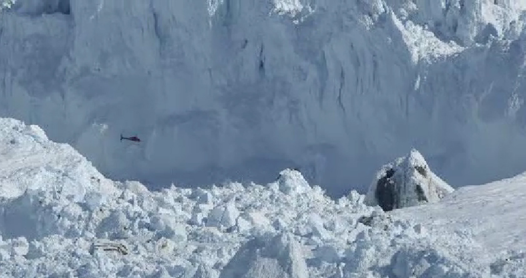
This is one of the most insane places on Earth. It is the terminus of the Jackobshavn Glacier as seen from the air while circling waiting for bad weather to clear at the airport in Ilulissat. The weather never did clear and we were forced to return 60 minutes by air from where we started and spend the night (Kangerlussuaq).
Most of our big meals will be backpacking pouch meals and these are really quite good these days and full of calories. A large variety will be brought along and this will be supplemented with cheese and bread and other local fair such as canned soup, potatoes and maybe a few vegetables from the local market. The ubiquitous snack bars will be available in plenty along with a few surprises. Warm clothing is a must which includes winter weight gear for southerners, even in mid-summer. Bring the best breathable (Goretex) raingear you can dare to afford. The weather is highly variable in Greenland and it rains often and the temperature drops immediately into the 40s then often into the 30s! We will not want to sit in our tents and wait. Frost is a regular occurrence in late summer and snow is not uncommon anytime.Breakfasts will be backpacking pouch wonders (again, really quite good) or breakfast bars, canned fruit and etc., and always excellent strong fresh ground coffee (or tea). Lunches will be canned meat, cheeses and bread or crackers and canned fruit. Fresh fruit and vegetables at the market in Greenland are a far cry from what we are accustomed to on the “outside.” A camp chair will be provided for your ice watching pleasure. Daily washing is done from a bucket. A “special bucket” with a special lid will be provided, placed in an appropriately secluded location or in its own special mini-tepee. The leader will take care of most of the camp chores, but participants will be expected to help here and there.A solar charged battery pack will be set up as a charging station for all to use but we will only have enough power for cameras and storage devices. If conditions allow, after all cameras and storage devices have been charged, there may be enough charge remaining for a tablet or two – no laptops please. Photographers: bring stand-alone storage and a few extra batteries just in case. All charging will be done in the evening to allow for prompt morning starts.Don’t forget personal medications! Prescriptions! Spare reading glasses! A book for… (I couldn’t be without mine…) a flashlight, a bandana or two, a pocket knife! Extra Socks! We will have a decent first aid kit, but please, try really hard not to break any bones. Trip insurance with injury and hospital coverage is mandatory. If you do get hurt, and these trips are on the edge of things, you will thank us for having the foresight to require trip insurance.Rates:Please contact us for rates. We are booking for the 2015 season now. Booking dates are early for these trips as there is a lot of interest and hotel accommodations fill by the first of the year.Trip Length: 7 daysDeparture Dates: Available by request, see the calendar or contact us with the contact form.Custom Tour: Want to extend a trip? How about a destination not listed or a combination other than what is listed? Contact us about a custom tour.
Town sized icebergs litter the icefjord at times. These billion ton bergs simply cracked off the terminus and floated away. They are called tabular bergs and mostly disintegrate to smaller billion ton bergs before they get to the mouth of the icefjord.
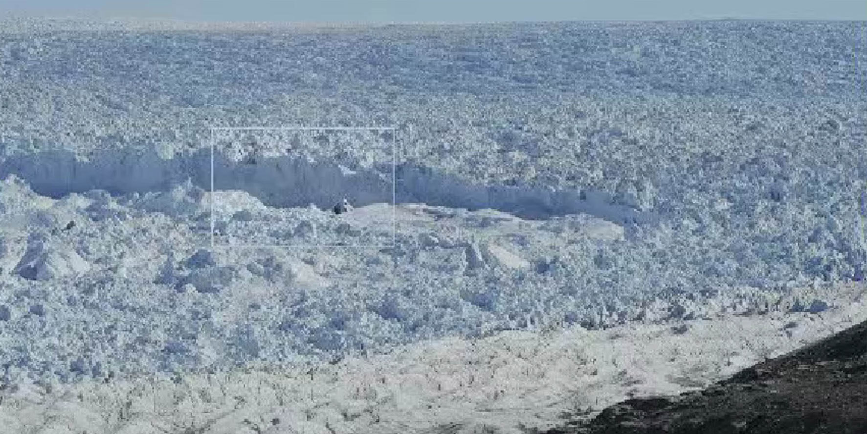
This is the terminus face of the Jackobshavn Isbrae (glacier). The portion extending above the icefjord is 300 feet high. Between 87 and 90 percent of floating ice is below the waterline. The icefjord extends beneath the ice sheet for hundreds of miles to the to where the great weight of ice has depressed Greenland in some places over over a thousand feet below sea level.
This is a closeup of the previous image showing how immense this glacier is. These two images come from a time lapse movie of the Jackobshavn terminus at the NASA Ice Viewer at about the place that our helicopter expeditions drop us off. The icefjord is 4,600 feet deep and the glacier extends 3,000 feet below the surface.
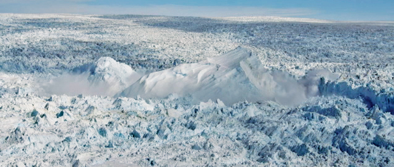
A half mile long iceberg is born. It launches into the air 800 or 900 feet as it explodes from far beneath the surface. These bergs can easily be the size of small towns. Imagine a small town launching into the air 800 or 900 feet. These events can include a half dozen of these town-sized bergs launching with each one taking minutes to roll over.
Engineer Pass in southwestern Colorado. The serious four-wheel drive trails are generally above treeline. In southwestern Colorado, the spruce beetle has attacked a million acres in the Weminuche Wilderness area. This attack is active and spreading into the four-wheel drive network of old mining roads to the north, between Silverton, Ouray, Durango, Creede and Lake City.